Archispace Store
ZWGeo 2026
ZWGeo 2026
Couldn't load pickup availability
ZWGeo 2026 dla ZWCAD Professional – Kompleksowe wsparcie dla branży geodezyjnej
ZWGeo 2026 to najnowsza wersja zaawansowanej nakładki na ZWCAD Professional, zaprojektowana specjalnie dla geodetów i projektantów opracowujących mapy do celów projektowych. W wersji 2026 narzędzie zyskało zoptymalizowane silniki obliczeniowe, które jeszcze sprawniej radzą sobie z dużymi zbiorami danych przestrzennych, czyniąc pracę z mapami numerycznymi szybszą i bardziej precyzyjną.
To niezbędne narzędzie dla każdego, kto na co dzień zajmuje się obsługą geodezyjną inwestycji, tworzeniem operatów czy przygotowywaniem dokumentacji podkładowej w środowisku CAD.
Kluczowe możliwości i funkcje ZWGeo 2026:
-
Obsługa standardów branżowych: ZWGeo 2026 oferuje pełną bibliotekę symboli i linii zgodnych z obowiązującymi standardami K1/G5, co zapewnia najwyższą jakość wydruków i zgodność dokumentacji z wymogami urzędowymi.
-
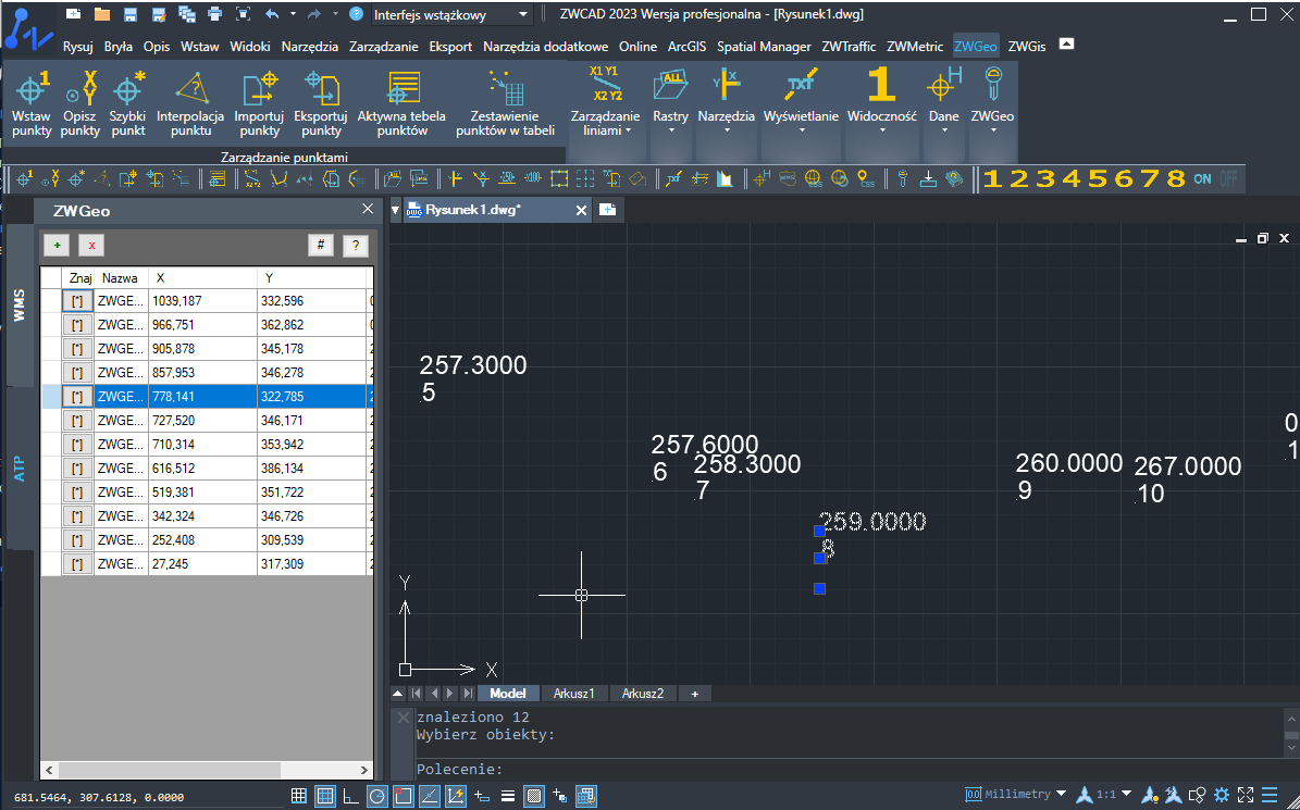
Automatyzacja rysowania map: Narzędzie automatyzuje nanoszenie elementów mapy, w tym warstwic, punktów pomiarowych, opisów wysokościowych oraz skomplikowanych obiektów liniowych, drastycznie redukując czasochłonność kreślenia.
-
Import i eksport danych: Bezproblemowa współpraca z zewnętrznymi danymi dzięki wsparciu dla formatów tekstowych oraz plików wymiany (np. TXT, CSV, GML), co pozwala na szybkie wczytywanie danych z tachimetrów i odbiorników GPS bezpośrednio na rysunek.
-
Narzędzia do tworzenia profili i przekrojów: ZWGeo 2026 zawiera dedykowane moduły do generowania profili podłużnych i poprzecznych terenu, co jest kluczowe w projektowaniu liniowym i dokumentacji inwentaryzacyjnej.
- Wygodne zarządzanie warstwami i opisami: Dzięki zaawansowanym funkcjom edycji, zarządzanie tysiącami punktów i setkami warstw staje się uporządkowane. Automatyczne generowanie tabel i zestawień punktów pozwala na szybkie przygotowanie załączników do operatów.
Dlaczego warto wybrać ZWGeo 2026 z naszej oferty?
Jako oficjalny i autoryzowany dealer oprogramowania ZWCAD oraz dedykowanych nakładek branżowych, gwarantujemy:
-
Legalność i pewność licencji: Kupujesz oprogramowanie bezpośrednio z oficjalnego kanału dystrybucji.
-
Kompatybilność: Nakładka wymaga do działania programu ZWCAD w wersji Professional. W naszym sklepie nabędziesz cały zestaw, aby mieć pewność, że wszystko zadział ja należy.
Zoptymalizuj procesy geodezyjne, wyeliminuj błędy przy tworzeniu podkładów i skup się na merytorycznej pracy z danymi, a nie na ręcznym kreśleniu symboli.
Dostawa opłaconego zamówienia odbywa się drogą elektroniczną w terminie do 2 dni roboczych.
Share